

There are some new nifty features in the OGN Logbook that you had not been told about. They are two rather nice and useful details some other fellow pilots already asked for or you might have desired.
Top Altitude During a Tow
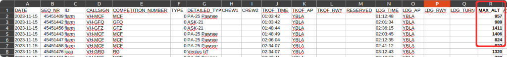
For over two years you could have downloaded a .csv file in FlightOffice format that can also be opened in LibreOffice Calc or in any other spreadsheet tools. This file contains an summary of air traffic for each particular field for given day. The .csv file is available for download at top of the page in the page header as highlighted in the following screenshot.

Let’s assume you are from the Benalla airport, Victoria, AU (YBLA) and you have just started there as a tug pilot and local procedures require to record the maximal tow altitude for each flight. You can either note it down onto your kneepad every time upon tow release or alternatively check the appropriate column (col. H, MAX_ALT) in the .csv file where the logbook has recorded it for you (assuming you start the descend right after the glider release, the tow plane is equipped with well working OGN, transponder or other device and the OGN network coverage at your location is good).
The file structure is clear from the first header row and is I believe pretty self-explanatory.
Multiple flights in the Map View
This is a nice to have when you want to compare your friend’s flight with yours. Even when we agree to fly together in wing-to-wing formation, our paths usually split after a short while and many times it might be interesting which path the other one took. This feature is to visualise where our trails crossed without even knowing and where we joined on the cross-country flight under the same cloud again. For adding a flight just click on the large blue plus (+) symbol in the upper right corner of the map view.
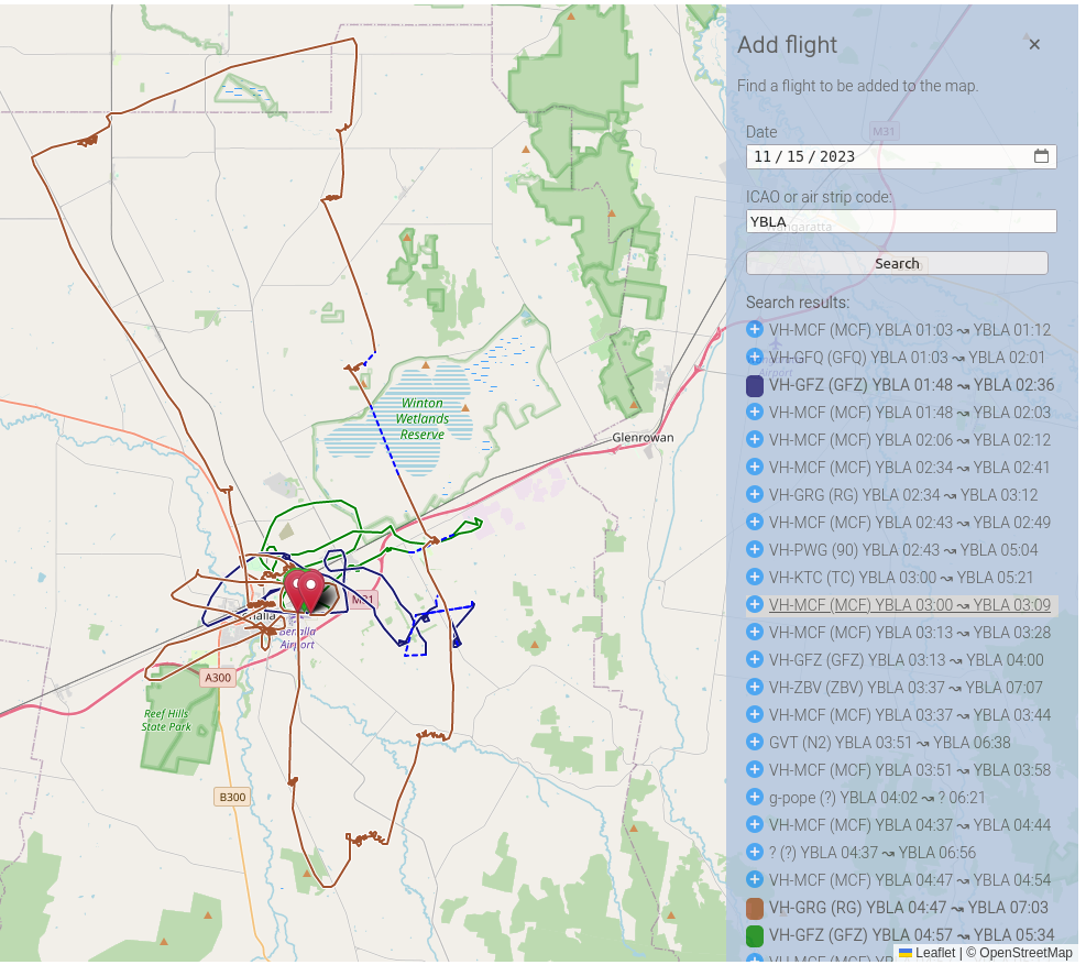
Here you can search for flights originating from the same airport (by default) of choose some other location your friend might have departed from. Furthermore, the date can also be modified if you want for example to overlay two or more flights from various days in the same map. Just remember that the flight-path retention period is not infinite, hence your early spring shenanigans won’t be probably not be available in late summer. Enjoy! 🙂